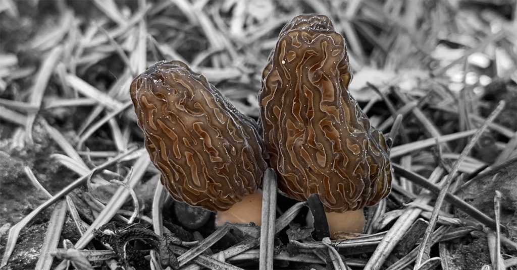
Morel Burn Map
Morel Mushroom Map 2025
Includes
- California
- Colorado
- Idaho
- Montana
- Oregon
- Washington
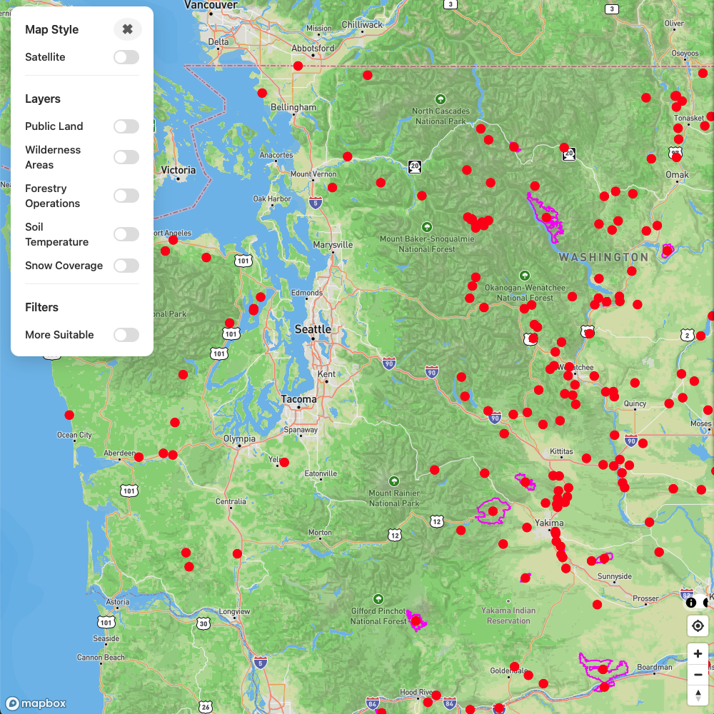
Overview Map
CO / ID / MT / OR / WA

Soil Temperature

Snow Cover
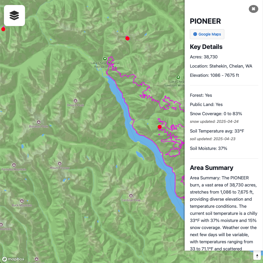
Area Summaries
Has Forest?
Has Public Land?
Soil Temp | Snow Cover | Soil Moisture
Weather Forecast
Recent Rain
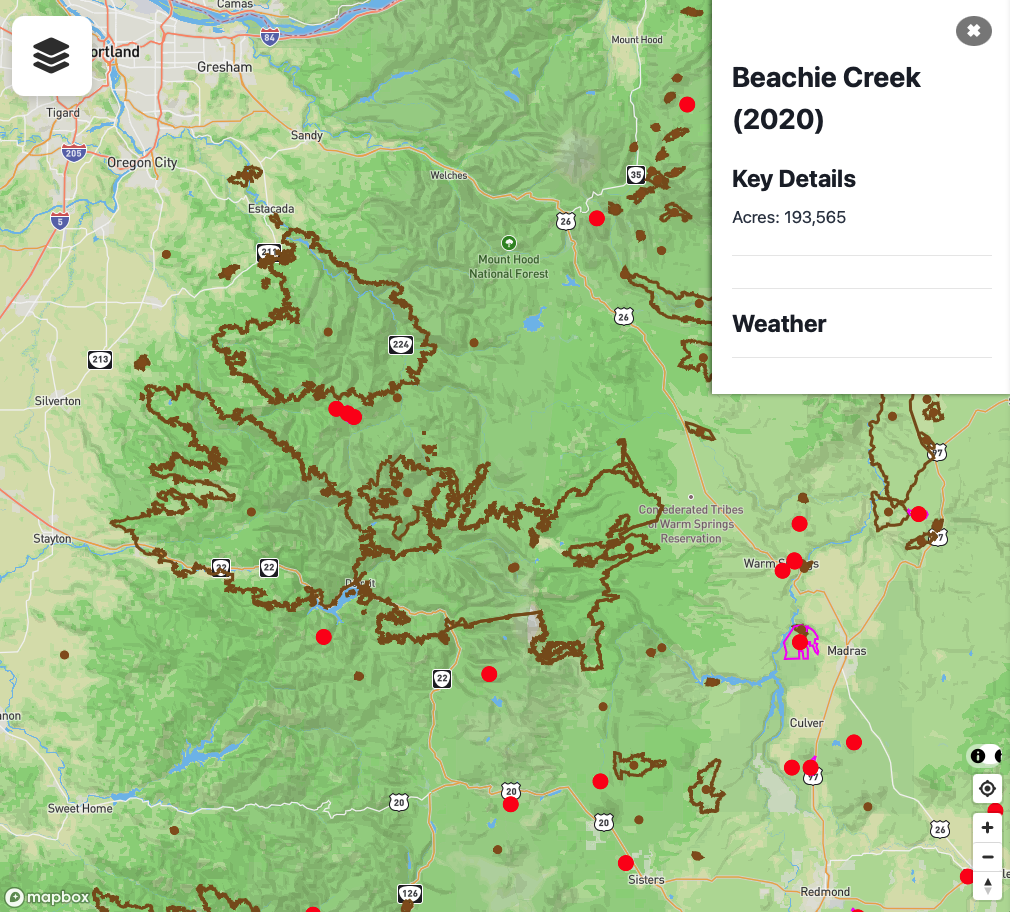
Past Burns
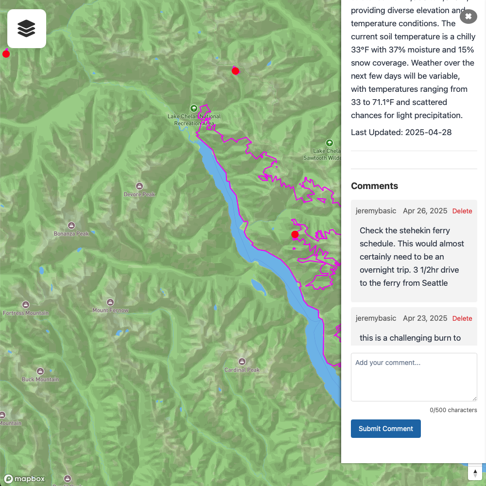
Review or Add Comments
Also includes a morels mini e-learning module (link)
Download KML for Gaia, onX, and other mapping applications
Download burn areas for uploading to Gaia, onX, and other navigation apps
Pro users can find KML download in the Account Page