2026 Morel Maps Burn perimeters, soil temperature, and snow cover for morel hunting in Washington, Oregon, and the western US

Morel season in the Pacific Northwest runs from March through July, depending on elevation and whether you’re hunting landscape morels or burn morels. The hard part isn’t finding morels once you’re in the right spot — it’s knowing which spot to drive to and when conditions are right.
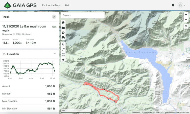
Forayz maps every recent wildfire perimeter across the western US alongside real-time soil temperature, snow cover, and precipitation data. Instead of guessing, you can scout burn sites from home, check whether the ground has warmed enough, and see if the snow has melted before making the drive.
Open the 2026 Morel Map
Burn perimeters, soil temperature, and snow cover — updated for the 2026 season. Free environmental layers for all members.
How to Use Forayz for Morel Hunting
Forayz isn’t a pin map of morel spots. It shows you the environmental conditions that cause morels to fruit — so you can find your own productive areas rather than competing for known locations.
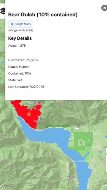
Step 1: Find burn sites
Turn on the Past Burns layer and filter to 2025 fires. First-year burns are the most productive for morels. Zoom into burns on public land (National Forest, BLM) and check the acreage — larger burns generally produce more morels, but even small burns can be productive if the forest was dense conifer.
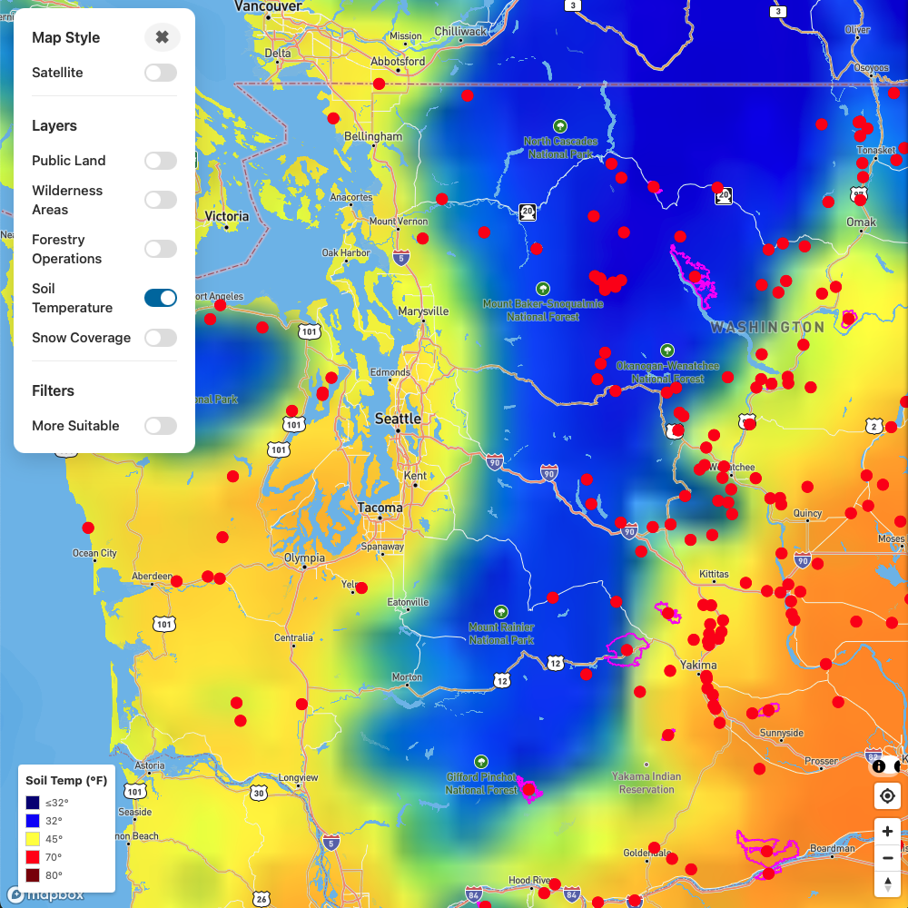
Step 2: Check soil temperature
Morels need soil temperatures around 50°F to fruit. Turn on the Soil Temperature layer and look for burns where the ground has warmed past that threshold. South-facing slopes warm first — they’re your earliest opportunities each season.
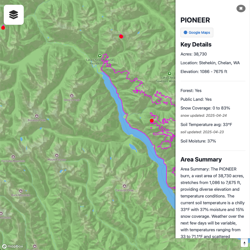
Step 3: Monitor snow cover
Many productive burns are at higher elevations where snow lingers into June or July. The Snow Cover layer shows current snowpack so you can time your trip — morels typically fruit 1–3 weeks after snowmelt at a given elevation.

Step 4: Check the details
Tap any burn perimeter to see its summary — acreage, discovery date, cause, and the current soil conditions within the burn. Check satellite imagery to verify the area was forested before the fire (grassland burns don’t produce morels).
2026 Season Timeline
Morel season progresses from low to high elevation across the spring and early summer. Here’s the general pattern for Washington and Oregon:
| When | What to Hunt | What to Watch on Forayz |
|---|---|---|
| March–April | Landscape morels in urban areas, woodchip beds, river valleys, cottonwood bottoms | Soil temp crossing 50°F at low elevations. 14-day precip for recent rainfall. |
| April–May | Natural morels in river valleys. Early burn morels at low-elevation fires. | Soil temp at burn sites. Snow cover retreating from lower burns. |
| May–June | Peak burn morel season at mid-elevation fires (3,000–5,000 ft). | South-facing slopes warming first. Snow cover retreating uphill. |
| June–July | High-elevation burns (5,000+ ft). North-facing slopes producing last. | Snow cover at highest burns. Late-season rain events triggering new flushes. |
Unlock burn maps and timber harvest data
Pro members get historical fire perimeters, timber harvest boundaries, detailed foraging area summaries, and offline maps in the Forayz app.
$14.99/year · No auto-renewal
First-year burns are best
The biggest morel flushes happen the first spring after a wildfire. Second-year burns can still produce, but yields drop significantly. Focus your scouting on 2025 fires for the best results this season.
For a deeper dive into morel hunting strategy, see our complete guide to finding morels in Washington.
Scout Your Burns Before You Drive
Check soil temp, snow cover, and fire details from home. Pro members get full access to burn perimeters, timber harvests, and offline maps.
What Forayz Shows You
Every data layer on Forayz is chosen because it matters for finding mushrooms. Here’s what’s relevant for morel hunting:

Soil Temperature
Daily NOAA data showing ground temps across the region. The key indicator for morel fruiting timing.
Free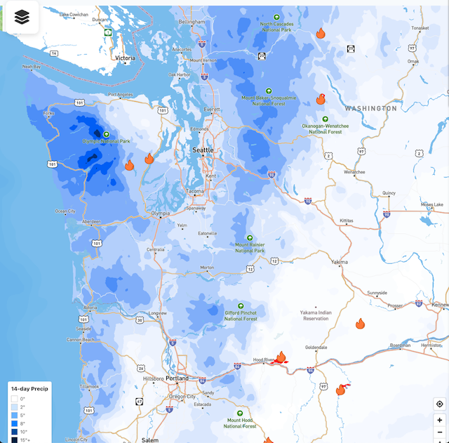
14-Day Precipitation
Recent rainfall data. Rain events after warm soil temperatures trigger morel flushes, especially at burn sites.
Free
Burn Perimeters
Every western US wildfire, filterable by year. Includes fire details, acreage, and cause.
Pro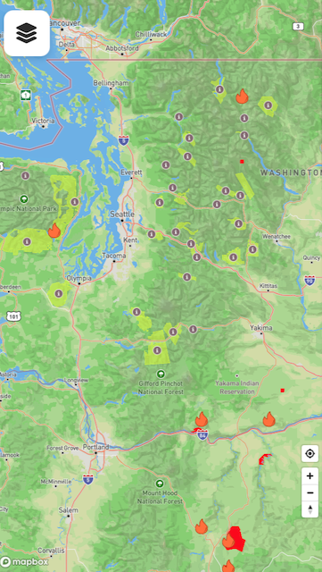
Areas of Interest
Curated foraging areas with habitat summaries — elevation, tree species, precipitation norms, and access notes.
ProAdditional layers include snow cover, soil moisture, ecoregions, precipitation normals, public land boundaries, and timber harvests (another morel trigger).
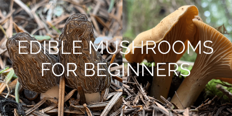
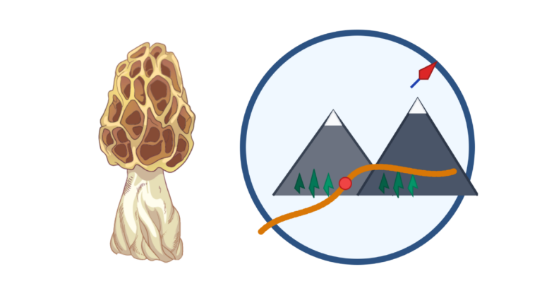
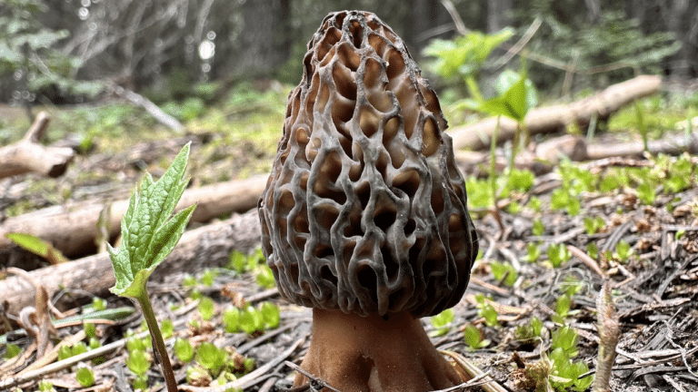
Learn to Identify Morels
Finding morels is only half the challenge — you also need to distinguish true morels from lookalikes. Our free morel course covers:
- True morel species in the Pacific Northwest — blacks, yellows, and landscape morels
- Verpa bohemica (early morel / false morel) — how to tell it from true morels and whether it’s worth eating
- Gyromitra (brain mushroom) — the genuinely dangerous lookalike and how to avoid it
- Cooking and safety — why morels must be thoroughly cooked, and the morels and alcohol question
Free morel identification course
Our online morel course is free for all registered members. It covers species identification, habitat preferences, and safe preparation — everything you need before your first morel hunt.
Available on Web, iOS & Android
Forayz works in your browser on any device. For offline maps in the field (essential at remote burn sites without cell service), download the native app:
- Web: salishmushrooms.com/forayz — no download needed
- iOS: Download on the App Store
- Android: Get it on Google Play
One account works across all platforms. Scout burns on your laptop, then take the same map offline on your phone when you head into the mountains.
Is This a Morel?
66 photos — true morels vs. look-alikes. Test your ID skills before you hit the field.
Get the data serious foragers use to find more mushrooms
Free members get soil temps, precipitation, and ecoregion data. Pro unlocks the layers that help you narrow down exactly where to look.
- Historical burn perimeters — find morel habitat fast
- Timber harvest boundaries across OR & WA
- Detailed foraging area summaries with conditions
- Offline maps in the Forayz iOS app