Finding Morels in Oregon Where, when, and how to hunt the Pacific Northwest’s most prized spring mushroom
Morels are the mushroom that gets Pacific Northwest foragers out of winter hibernation. From valley woodchips in March to high-elevation burn sites in July, morel season in Oregon stretches across four months and a remarkable range of country — from the oak savannas of the Willamette Valley to the dry pine forests of the Blue Mountains.
This guide covers the four types of morels you’ll find across Oregon, how to time your hunts from the valley floor to the high Cascades, and how to use burn maps and soil data to find productive spots.
2026 Morel Maps Are Live
Burn perimeters, soil temperature, snow cover, and morel fruiting predictions for towns across Oregon and Washington. Updated for the 2026 season.
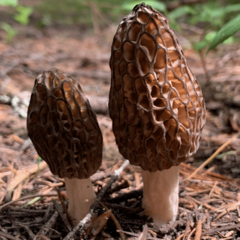
Four Types of Morels in Oregon
Not all morels are the same. Oregon has four distinct types, each with different habitats, timing, and hunting strategies. Understanding which type you’re after determines where and when to go.
Landscape Morels
Morchella importuna
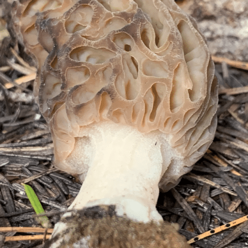
The easiest morels to find. Fruit in woodchip mulch — garden beds, park paths, commercial landscaping. Check chips that were spread the previous year. Peak season is March through April in the Willamette Valley and along the coast.
March–April Urban / SuburbanYellow Morels
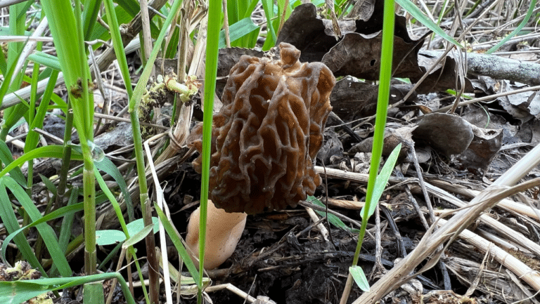
Morchella americana
Found along rivers and streams near cottonwood and ash trees. Sandy river bottoms in the Willamette Valley and along eastern Oregon’s rivers are prime habitat. Many spots produce year after year.
April–June Riparian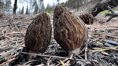
Burn Morels
Morchella spp.
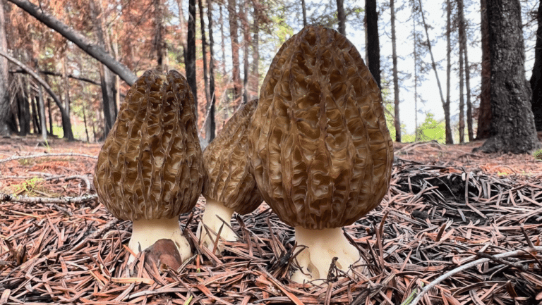
The big prize. Massive fruitings in forests that burned the previous year. South-facing slopes warm first; north-facing slopes produce later. The Cascades and the Blue Mountains can fruit by the thousands in the right conditions.
May–July Fire Sites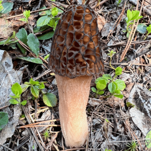
Natural Morels
M. brunnea, M. snyderi, M. norvegiensis
The least understood group. These fruit with living trees — M. brunnea under hardwoods like Oregon white oak, M. snyderi with true firs, and M. norvegiensis with conifers at higher elevations. Smaller fruitings than burns, but reliable spots produce annually.
April–June Mountain ForestsUnlock burn maps and timber harvest data
Pro members get historical fire perimeters, timber harvest boundaries, detailed foraging area summaries, and offline maps in the Forayz app.
$14.99/year · No auto-renewal
When to Hunt: Morel Season Timing
Morel season in Oregon runs from March through July, but the timing depends on elevation, aspect, and weather. The state covers a huge elevation range — from the valley floor near sea level to the high Cascades and the Wallowas above 7,000 feet — so the season rolls uphill and eastward as spring progresses. Warmth drives the early season; moisture matters more later on.
| Window | Where to Look | What to Find |
|---|---|---|
| March–April | Valley towns — Portland, Salem, Eugene; garden beds, parks, the coast | Landscape morels in year-old woodchips |
| April–May | Willamette, Umpqua & Rogue river valleys; low-elevation foothill burns | Yellow morels near cottonwoods; early burn morels on south-facing slopes |
| May–June | Mid-elevation Cascade burns (Willamette, Umpqua & Mt. Hood forests), mountain valleys | Burn morels as snow melts and soil warms above 45°F |
| June–July | High Cascade and Blue Mountain burns, north-facing slopes | Late-season burn morels; rain events can trigger new flushes |
The 50°F rule
Morel fruiting is strongly correlated with soil temperature reaching about 45-50°F (8-10°C). Early in the season, warmth is the limiting factor. Later, moisture becomes critical — exposed burn areas dry out fast, and a late-spring rain can trigger a whole new flush in ground that’s already warm enough. This is especially true east of the Cascades, where the climate is drier.
Use Forayz to check real-time soil temperature and 14-day precipitation for specific areas you’re scouting.
Finding Yellow Morels
Yellow morels (Morchella americana) are the classic riparian morel of the Pacific Northwest. They grow along rivers and streams, typically in sandy soil near cottonwood and ash trees. In Oregon, the Willamette Valley bottomlands and the river corridors of the eastern half of the state are the most productive areas.
Where to look
- River bottoms with cottonwood: The strongest association. Look for black cottonwood (Populus trichocarpa) along the Willamette and its tributaries, and along eastern Oregon rivers like the Deschutes, John Day, and Grande Ronde.
- Ash groves: Oregon ash along sloughs and waterways throughout the Willamette Valley.
- Sandy, well-drained soil: Morels prefer loose soil that warms quickly in spring.
How to hunt them
- Move slowly. Morels blend into leaf litter and dappled shade.
- Get low — changing your angle makes a huge difference.
- When you find one, stop and search a 10-foot radius carefully. They cluster.
- Revisit productive spots. Yellow morels associated with living trees often fruit in the same locations year after year.
Challenges
Riparian morel spots are often difficult terrain — expect blackberry thickets, uneven ground, and competition from other foragers at accessible sites. Much of the Willamette Valley floor is also private farmland, so confirm access and ownership before you hunt, and be selective about water quality where you harvest for the table.
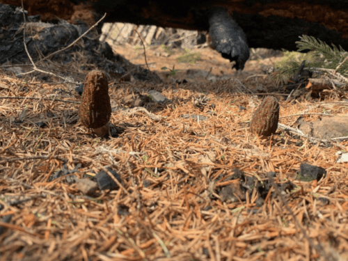
Finding Natural Morels
Natural morels are the group most foragers overlook. Unlike burn morels (which respond to tree death) or landscape morels (which colonize woodchips), natural morels form ongoing relationships with living trees and fruit in the same spots year after year.
Three species are most relevant in Oregon and Washington:
- Morchella brunnea — Associates with hardwoods, particularly Oregon white oak (Quercus garryana). Look in the oak savannas of the Willamette Valley and the oak woodlands of the Umpqua and Rogue valleys in southern Oregon. These are among the earliest morels of the season.
- Morchella snyderi — Associates with true firs (Abies spp.), especially grand fir and Pacific silver fir. Found in mid-elevation eastern Cascades, often along old logging roads and forest openings. Fruits from late April through June.
- Morchella norvegiensis — Associates with conifers and is reported to be the most common natural morel in the Pacific Northwest.
Natural morels tend to fruit in smaller quantities than burn morels, but a known spot can produce reliably for years. Pay attention to the specific trees around any morel you find — if there’s no recent fire or woodchips involved, you’ve likely found a natural morel, and that location is worth marking and revisiting.
Hunting Burn Morels
Burn morels are where the big numbers are, and Oregon is some of the best burn-morel country in the West. A productive burn site can yield hundreds of morels in a single trip. The key is finding the right burn at the right time.
How burn morels work
When a forest fire kills conifer trees, the mycorrhizal fungi associated with those roots lose their host. In response, many species produce a massive fruiting the following spring — a last effort to spread spores before the mycelium dies. First-year burns are the most productive, with diminishing returns in year two and three.
Oregon’s fire-prone national forests make this a reliable strategy most years. The west-Cascade forests (Willamette, Umpqua, Mt. Hood, and Rogue River–Siskiyou) and the drier east-side forests of the Blue Mountains (Wallowa-Whitman, Umatilla, Malheur, Ochoco, and Deschutes) routinely produce burn flushes the spring after a fire.
Using Forayz to find burns
The Forayz map is built for exactly this kind of scouting. Here’s what to look at:
- Burn perimeters: View outlines of recent wildfires across Oregon, Washington, and the Western US. Filter by year to focus on last year’s fires.
- Soil temperature: Track when burn areas cross the 50°F threshold.
- Snow cover: Monitor snowmelt at higher elevations — morels won’t fruit under snow.
- Area summaries: Check elevation, tree types, and public land status for each burn.
Scout Burn Sites Before You Drive
Check soil temperature, snow cover, and burn conditions from your phone. Forayz Pro includes burn maps, timber harvests, and offline map downloads.
Burn morel hunting tips
- Target first-year burns for the highest productivity.
- Start on south-facing slopes — they warm earliest and produce first.
- Move to north-facing slopes as the season progresses and the south sides dry out.
- Look at burn edges where some trees survived. Moderate burn severity often outproduces total incineration.
- Check near partially burned conifers — the dying root systems are what trigger fruiting.
- Be prepared for rough terrain. Burned forests mean downed trees, unstable ground, and limited shade.
Your Oregon Mushroom Hunting Map
There’s no secret map marking exactly where mushrooms grow in Oregon — but the next best thing is a map of the conditions that produce them. The Forayz map is a free Oregon mushroom hunting map that layers the data foragers actually use: recent burn perimeters across Oregon’s national forests, live soil temperature, snow cover, 14-day precipitation, public-land boundaries, and town-by-town fruiting predictions.
For morel hunters, it’s built around the three questions that make or break a trip:
- Where did it burn? Recent wildfire perimeters across the Oregon Cascades, the Blue Mountains, and the rest of the West — filter by year to find last season’s first-year burns.
- Is the ground warm enough? Live soil temperature, so you can see when an area crosses the 50°F fruiting threshold.
- Can I get there? Snow cover at elevation plus public-versus-private land lines, so you don’t drive to a snowed-in road or a locked gate.
Open the Oregon Mushroom Hunting Map
Free environmental layers for every forager — burn maps, soil temperature, and offline downloads with Pro. Covers all of Oregon and the Western US.
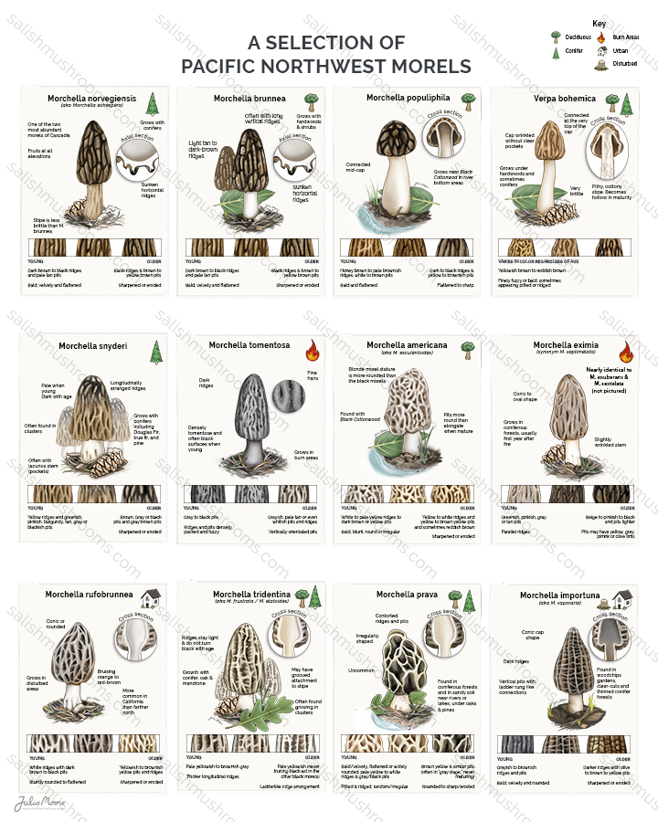
Illustrated Field Reference
PNW Morel Identification Chart
Illustrated guide to Pacific Northwest morel species — characteristics, habitat, and tree associations. Available as a print poster or digital download.
From $7.99 digital · $9.99 print · $29.99 poster
Staying Safe
Morel hunting often takes you into remote, rugged terrain — especially burn sites and the back roads of eastern Oregon. A few basics that matter:
- Tell someone where you’re going and when you plan to return.
- Download offline maps before you leave cell service. Forayz, Gaia GPS, and onX all support offline downloads.
- Bring more water than you think you need. Burn areas are hot and exposed, and east-side forests are dry.
- Watch your footing. Burned root holes, loose soil, and falling snags are real hazards in burn areas.
- Drive carefully. Forest roads in spring can be muddy, washed out, or blocked by downed trees. The drive is often the most dangerous part of the trip.
Harvest Ethics & Permits
There’s limited research on whether cutting vs. pulling, mesh bags, or leaving some behind actually affects future fruiting. What does matter:
- Permits: Most Oregon national forests require a free-use permit for personal harvesting and a paid permit for commercial harvesting. Rules and free-harvest limits vary by forest — check the district you’re headed to (Willamette, Deschutes, Mt. Hood, Umpqua, Wallowa-Whitman, and others each set their own).
- Wilderness areas are generally off-limits to mushroom harvesting.
- Respect private property. Much of the Willamette Valley is private farmland — always verify land ownership before foraging.
- Cut at the base rather than pulling to avoid disturbing the soil — this is the Forest Service recommendation.
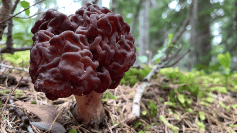
- Don’t harvest mushrooms you can’t identify. False morels (Gyromitra) grow in similar habitats and are toxic.
Learn More
Morel hunting rewards persistence. Every trip teaches you something — even the ones where you come home empty-handed. The best morel hunters just put in more miles.
Is This a Morel?
66 photos — true morels vs. look-alikes. Test your ID skills before you hit the field.
Get the data serious foragers use to find more mushrooms
Free members get soil temps, precipitation, and ecoregion data. Pro unlocks the layers that help you narrow down exactly where to look.
- Historical burn perimeters — find morel habitat fast
- Timber harvest boundaries across OR & WA
- Detailed foraging area summaries with conditions
- Offline maps in the Forayz iOS app