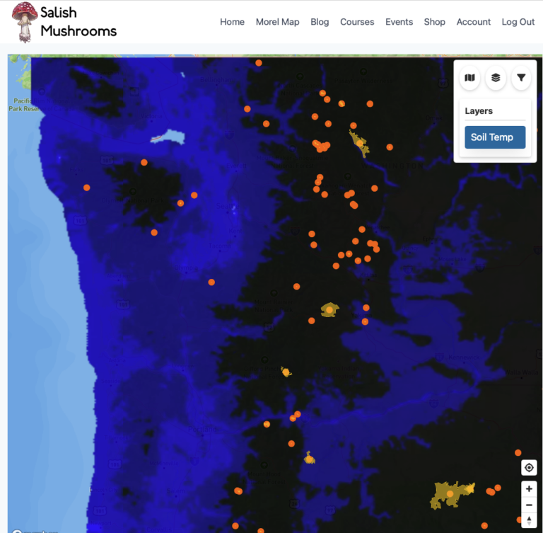
New on Forayz: Forest Types Layer See where your target mushroom habitats grow across the Pacific Northwest
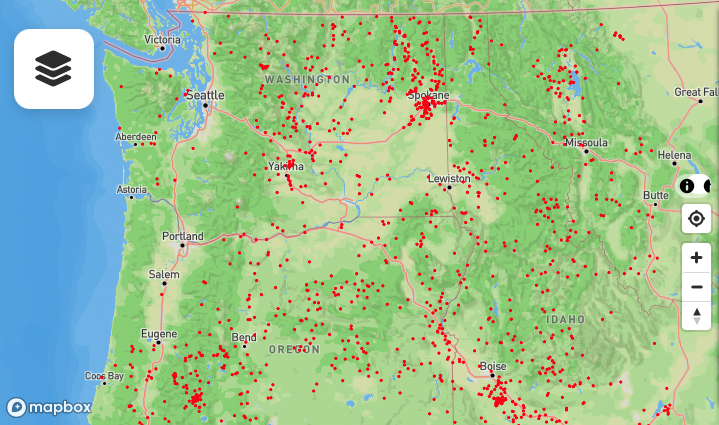
If you’ve ever stared at a topo map wondering whether that mountainside is old-growth Doug fir or logged-over alder, we just made your life easier. Forayz now includes a Forest Types layer that maps ten distinct forest habitats across the Pacific Northwest using LANDFIRE vegetation data.
Each forest type is associated with different mushroom species. Instead of driving to a trailhead and hoping, you can now verify the dominant tree species from home and plan your forays around the habitats you want to target.
Try the Forest Types Layer
Open Forayz, tap Layers, and expand the Forest Types section. Available now for Pro members.
Why Forest Types Matter for Foraging
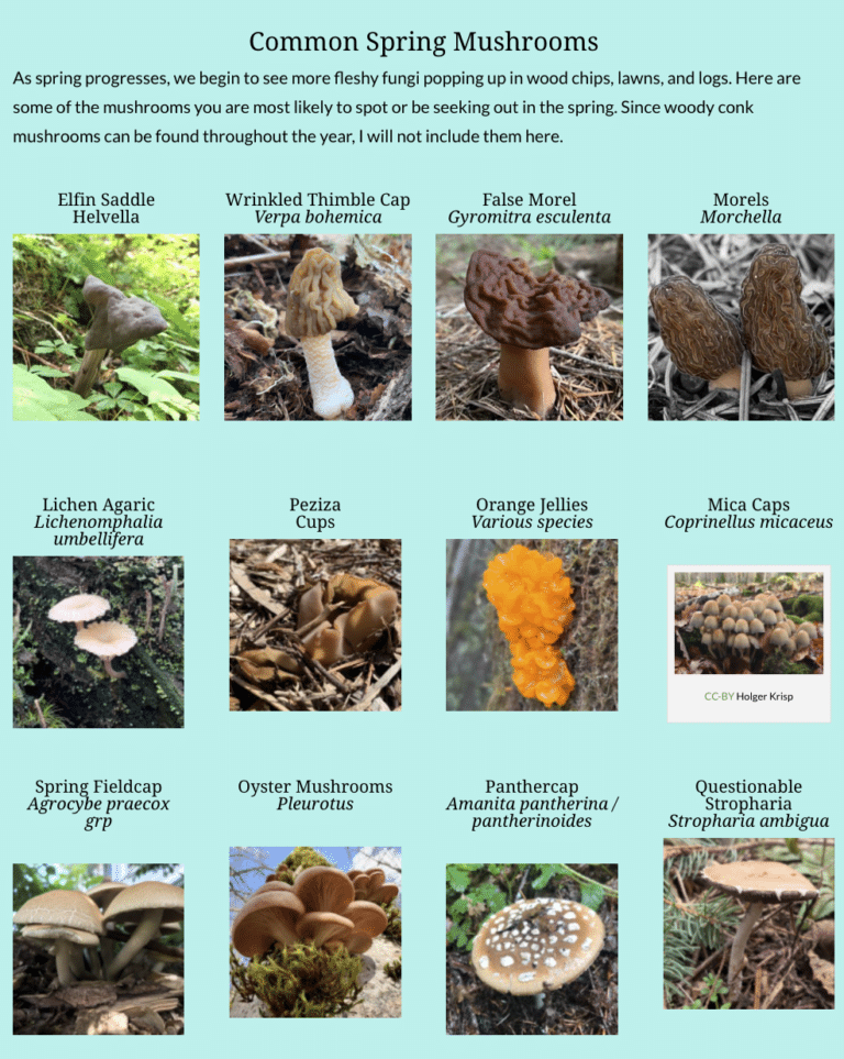
Mushrooms are not random. Most prized edible species in the PNW have specific tree partners. Chanterelles and bear’s head tooth fruit under Douglas fir and western hemlock. King boletes favor spruce and fir at higher elevations. Morels and verpa flush under cottonwoods in river valleys each spring.
The Forest Types layer gives you a fast visual answer to the question: “What trees are growing there?” — without leaving your couch. Overlay it with soil data, burn perimeters, and public land boundaries, and you’ve got a complete picture of whether a spot is worth the drive.
Ten Forest Habitats, One Map
We mapped the dominant forest types across Washington, Oregon, Idaho, Montana, and beyond, using LANDFIRE’s Existing Vegetation Type (EVT) 2023 dataset. Select one at a time to highlight it on the map:
Coastal Rainforest
Sitka spruce, western red cedar, western hemlock. Chanterelles and bear’s head tooth thrive here.
W. Cascades Conifer
Douglas fir and western hemlock mix. Classic chanterelle and bear’s head habitat.
High Cascades Fir
Pacific silver fir and noble fir at elevation. Prime king bolete territory after snowmelt.
Ponderosa Pine
Open, dry forests east of the Cascades.
Lodgepole Pine
Thin, dense stands at mid to high elevation.
Rocky Mtn Douglas-fir
Interior Douglas fir in drier climates. Burn morel hotspots.
Rocky Mtn Spruce-Fir
Engelmann spruce and subalpine fir. High-elevation burn morels and king boletes.
Black Cottonwood
Riparian corridors and floodplains. Landscape morels and verpa in spring.
Garry Oak
Oregon white oak savanna and woodland.
California Oak
Southern Oregon and California oak woodlands.
Radio selection keeps it clean
Forest Types use radio-button selection — only one shows at a time. This keeps the map readable while you compare different habitats against your other layers like burn perimeters or soil temperature.
How to Use It
Planning a burn morel trip? Turn on the Past Burns layer, find a promising fire, then switch to Forest Types and check whether the burn area was conifer forest (productive for morels) or grassland (not productive). Rocky Mountain Douglas-fir and spruce-fir burns are the classic high-yield morel habitats.
Looking for spring morels and verpa? Select Black Cottonwood and scout the riparian corridors and floodplains where landscape morels fruit each spring. These river-bottom habitats are some of the earliest producers of the season.
Scouting for chanterelles or bear’s head? Select W. Cascades Conifer or Coastal Rainforest and look for large contiguous patches of Douglas fir and western hemlock on public land. Cross-reference with the precipitation layer to find areas that got recent rain.
Hunting king boletes? Check High Cascades Fir and Rocky Mtn Spruce-Fir for the spruce and fir stands where boletes fruit at elevation after snowmelt.
Data source
Forest type boundaries come from LANDFIRE‘s Existing Vegetation Type (EVT) 2023 dataset, a nationwide mapping program maintained by the US Geological Survey and US Forest Service. We grouped their detailed vegetation classes into the ten forest types most relevant to PNW mushroom foraging.
Keep Learning
The Forest Types layer is one piece of the puzzle. Here are more tools to level up your foraging:
About Forayz Maps
Full guide to every layer, feature, and data source on the Forayz platform.
Free guide
Morel Identification Lesson
Learn to tell true morels from lookalikes. Species, habitat, and safe preparation.
Free course
“Is This a Morel?” Quiz
Test your ID skills on real photos. Can you spot the true morels from the lookalikes?
Free quiz
Open Forayz and Explore Forest Types
Pro members get full access to Forest Types, burn perimeters, timber harvests, and offline maps. Free members can explore environmental layers and public lands.
Get the data serious foragers use to find more mushrooms
Free members get soil temps, precipitation, and ecoregion data. Pro unlocks the layers that help you narrow down exactly where to look.
- Historical burn perimeters — find morel habitat fast
- Timber harvest boundaries across OR & WA
- Detailed foraging area summaries with conditions
- Offline maps in the Forayz iOS app