Yesterday we flew from Seattle to San Diego, door-to-door took about 6 hours. We intend to take the next 5 months slowly working our way back home. An ideal scenario is to walk the length of the Pacific Crest Trail from the US-Mex border at Campo, California to the US-Can border. We’ve also set a goal of returning home by Oct 1 to capture peak mushroom season in Washington.
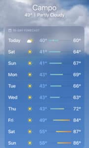
Tomorrow we will take a shuttle that runs daily from San Diego to Campo. The trip includes 2 key stops for last minute supplies; a grocery store, and REI. The weather in Campo looks amazing for the next week.
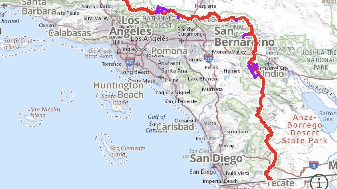
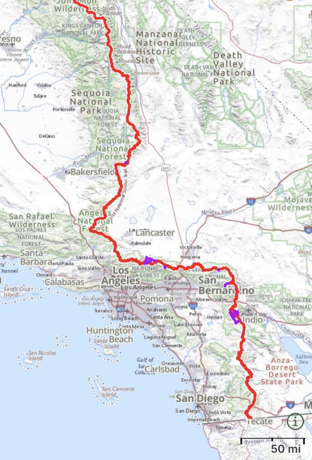
Once on the trail we walk north for 250 miles passing near Palm Springs to the San Bernardino National Forest. Then we head west, crossing the San Gabriel Mountains northeast of LA.
We will take it slow the first couple of weeks while we work on our trail legs and we will have pretty regular resupply stops throughout the first month. It looks like we have options for stopping into towns for grocery or cafes at miles 40, 80, 100, 150, and 180 in Idyllwild, CA.
Here are some key waypoints and a rough estimate for when we might arrive
May 6 – Campo (walking mostly north)
May 15 (110mi) – Warner Springs
May 21 (180mi) – Idyllwild
May 26 (266mi) – Big Bear City (turning west)
Jun 3 (340mi) – Cajon Pass
Jun 10 (430) – closest to LA then heading NW
Jun 17 (517mi) – Hiker Town
Jul 1 (703) – Kennedy Meadows (South)
These dates are only marginally rooted in reality and our daily mileage will be much easier to estimate once on the trail.
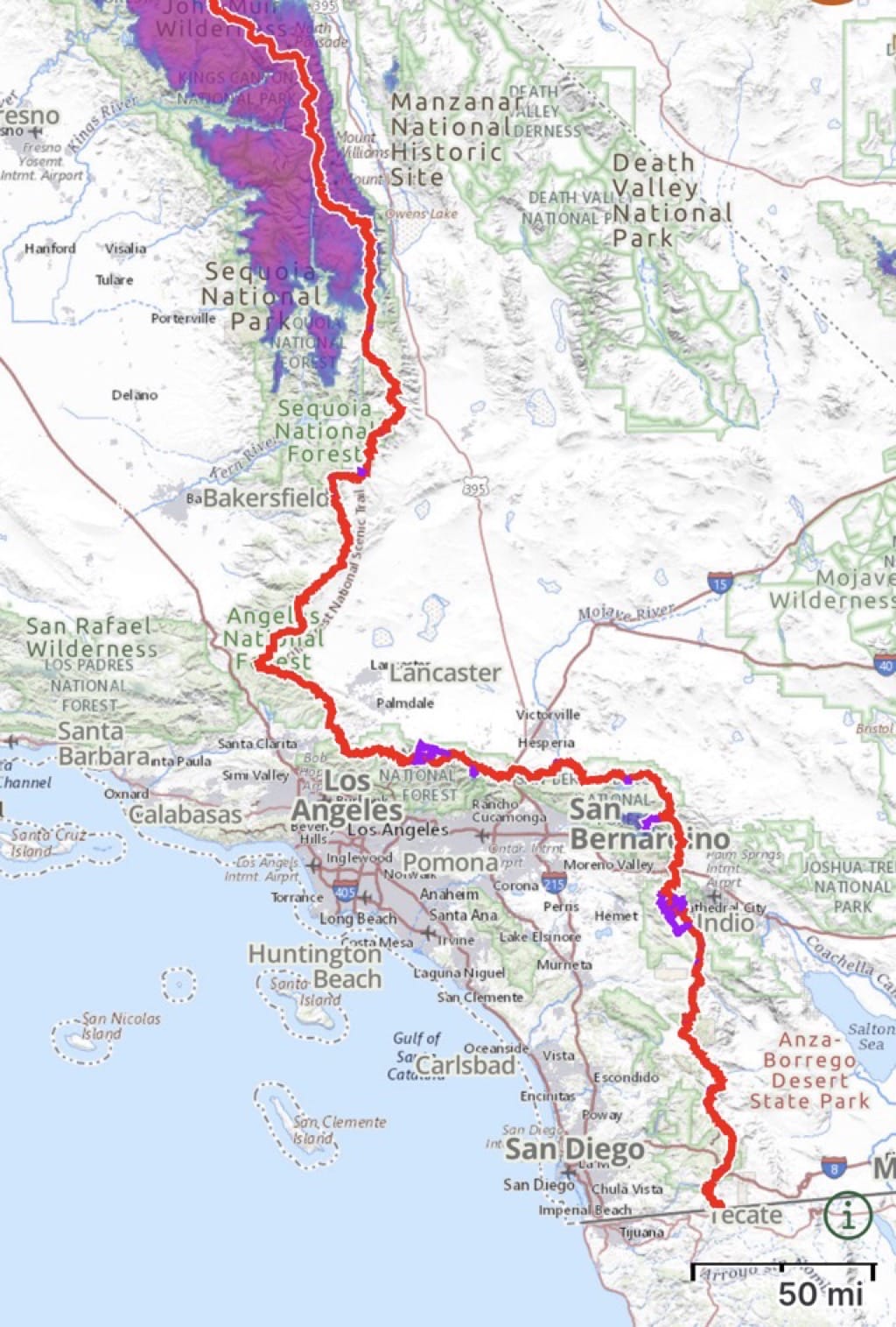
Kennedy Meadows South is the entrance to the Sierra and will be a key decision point for us. Snowpack in the Sierra is currently 200-300% of normal and conditions could be quite difficult when we arrive. A lot can change over the next 6-8 weeks and we will decide how to proceed as we get closer.
the purple in this map represents snowpack
 Some hikers choose to skip forward, wait it out for a bit for conditions to improve, or head into the Sierra with some combination of the appropriate gear, adequate training, hope, and good fortunes.
Get the data serious foragers use to find more mushrooms
Free members get soil temps, precipitation, and ecoregion data. Pro unlocks the layers that help you narrow down exactly where to look.
- Historical burn perimeters — find morel habitat fast
- Timber harvest boundaries across OR & WA
- Detailed foraging area summaries with conditions
- Offline maps in the Forayz iOS app