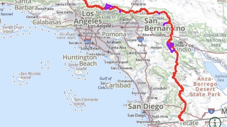
Background
The first part of the PCT is primarily a desert starting at the Mexico border at Campo, Ca. The trail continues north for 250 miles to Big Bear Lake, where it turns directly west towards LA.
About 30mi North of LA the trail again heads North, then Northeast another 300 miles to the southern end of the Sierra Nevada range.
We ‘got off trail’ at mile 650 before hitting the Sierra and picked up the trail again at mile 1150 near Truckee, Ca.
Northern California (trail mile 1150 / 650 hiked)
Over the past 2 weeks we walked about 200 miles from Truckee to Chester. This section started out in the snow which is why many people skipping the Sierra and instead chose to head straight to Chester. By the time we arrived the snow had melted considerably and some of the challenging sections could be avoided some rerouting.
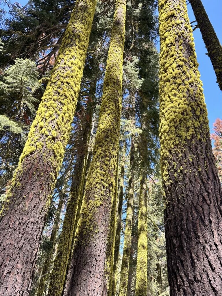
One of the things I really enjoyed about this part of the trail was the narrow window between snow-covered, and tinder box dry. After being in the high desert for 6 weeks, it was almost like waiting for a jack-in-the-box to spring seeing little signs of life shoot up from soil moistened by snowmelt. Enormous Douglas Fir trees were sometimes covered in neon green lichen, and we found fields of wildflowers where the snow was fully melted
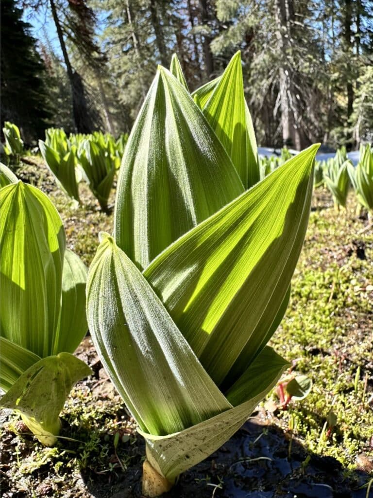
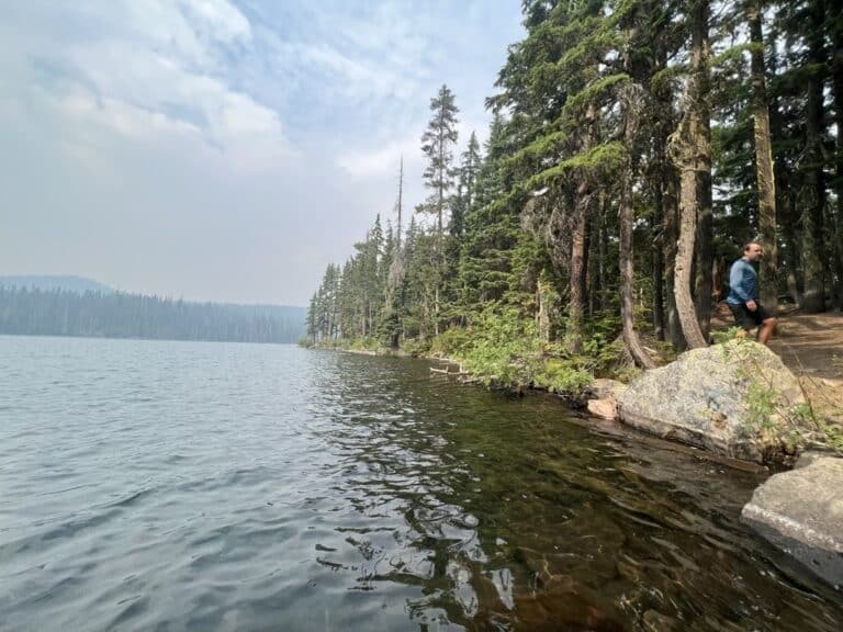
Another big change from the desert was the abundance of water. With snow melting all around us, nearly all of the seasonal streams were reliable sources for our next fill up
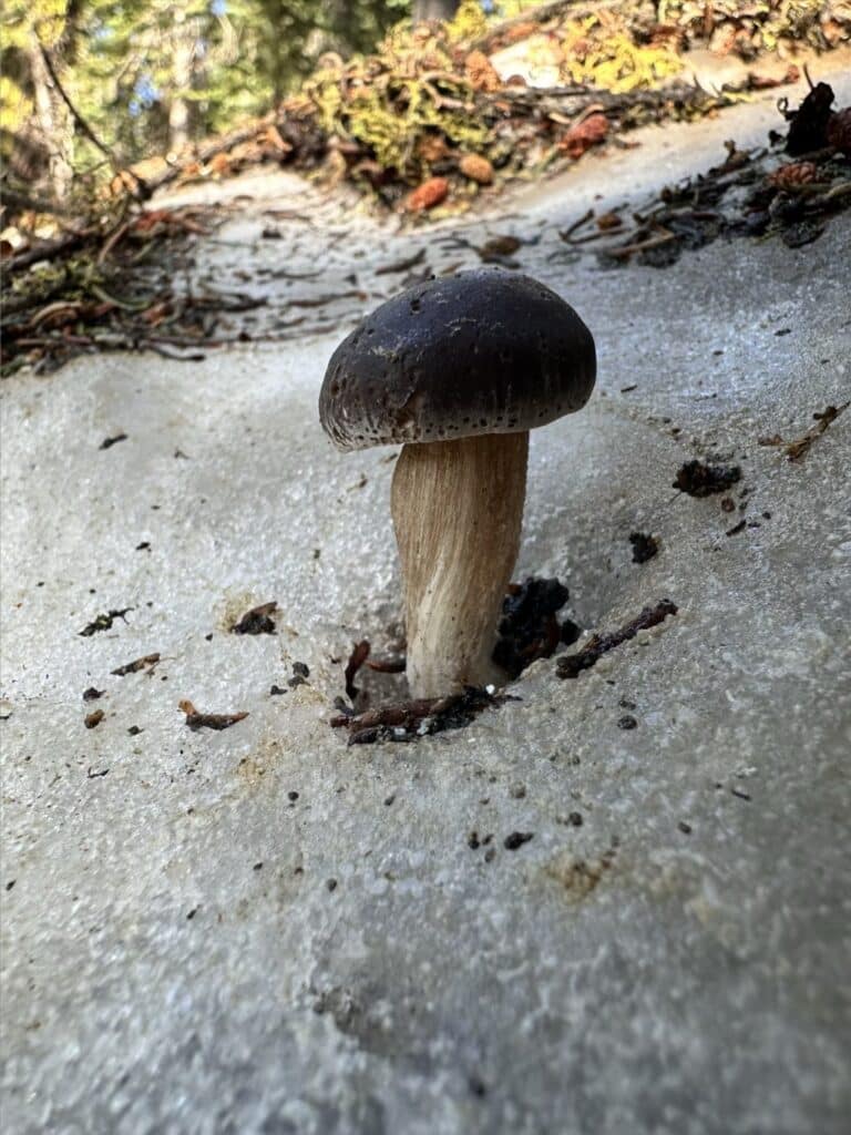
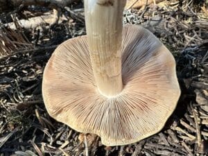
We also started to find new mushrooms; sometimes even growing right through the snow
This section of trail had a lot fewer people on it than the last section of the desert. Some of this is due to people leaving the trail entirely. Since the Sierra was such a mess this year with snow and now high flow rivers/creeks, many people are skipping around to different parts of the trail so the natural bubbles of people that coalesce don’t form like they would if everyone was hiking the trail sequentially.
Many of the people we did see had an entirely different appearance than the hikers we left 500 miles back. These are the hikers that came through the Sierra walking those same 500 miles we skipped. After spending 4-6 weeks walking half the speed they might have on dry ground, most have lost a considerable amount of weight, and from gear to body seem weathered. Most of these hikers talk about weeks of discomfort and some slightly dangerous snowfield or river crossings.
My pack continues to shrink. Now that we’re past the heavy snow areas and the weather continues to warm, it’s much easier to send home some of the gear I’ve been carrying around but rarely using
Some of my recent gear shedding included wool long-johns, the bottom 1/4 of my foam sleeping pad, rain pants, a bear canister, and crocs (as camp shoes). We can carry less water now that we are coming across streams regularly, and we are slowly getting food dialed in so that we’re not carrying too much more than we need to get to the next resupply.
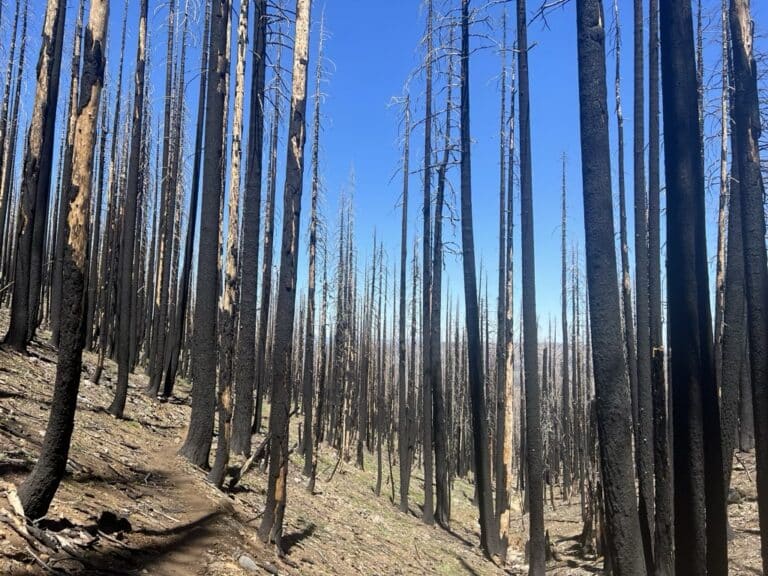
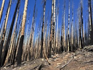
Some of the challenges with this section have been long stretches of burn scars, increasing temperatures, and mosquitoes. The burns seem to wear me down both physically and mentally. I’ve had short bouts of depression which could be related to some combination of the heat, nutrition, hydration, and/or hours of hiking through sterile soil and ash.
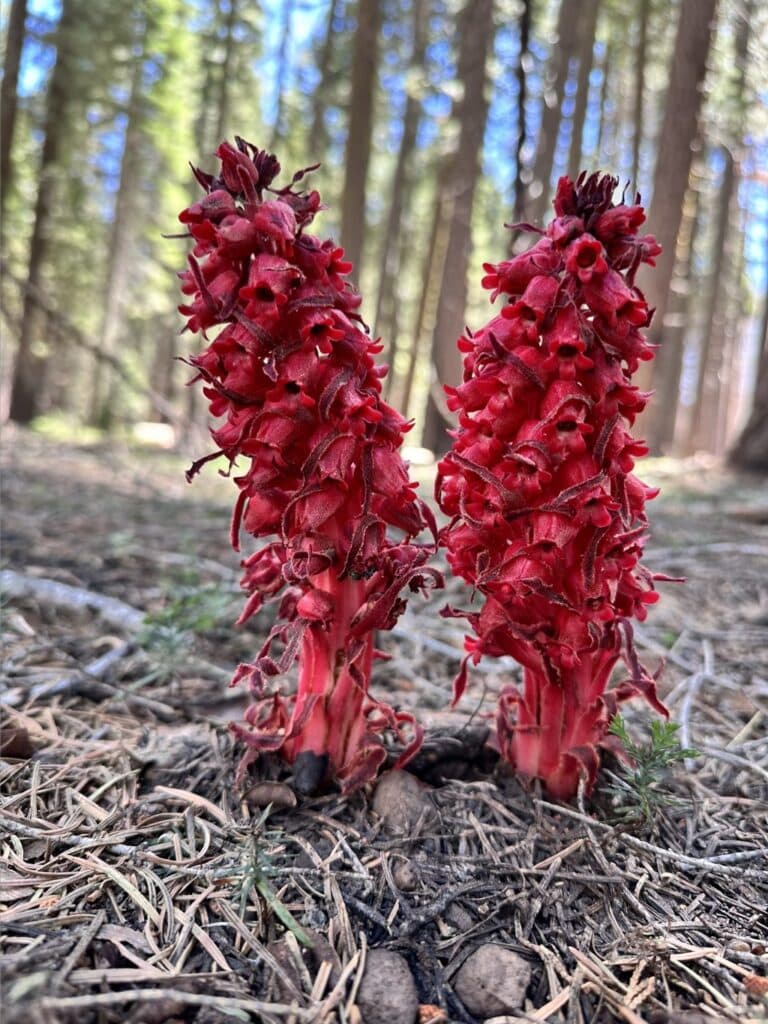
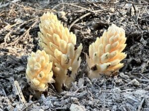
There is new life that springs up from the burn but the trees and shade are missed.
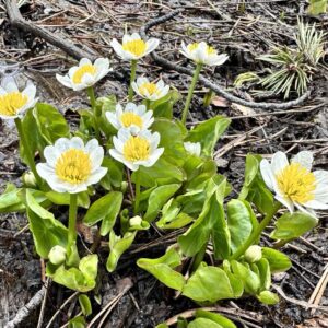
I have been posting about these plants on Instagram as well. Both of these are non-photosynthesizing plants that instead get their food from a fungus-tree partnership that they parasitize.
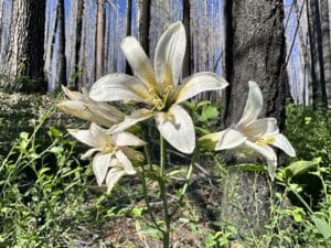
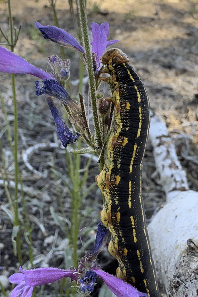
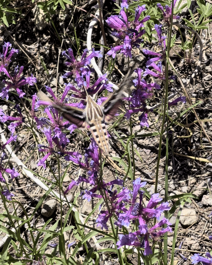
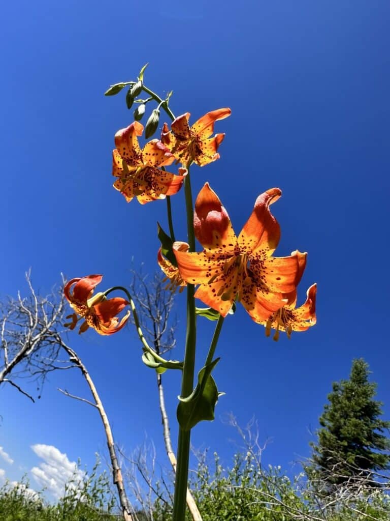
Here are some lilies we see occasionally
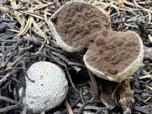
Mushrooms
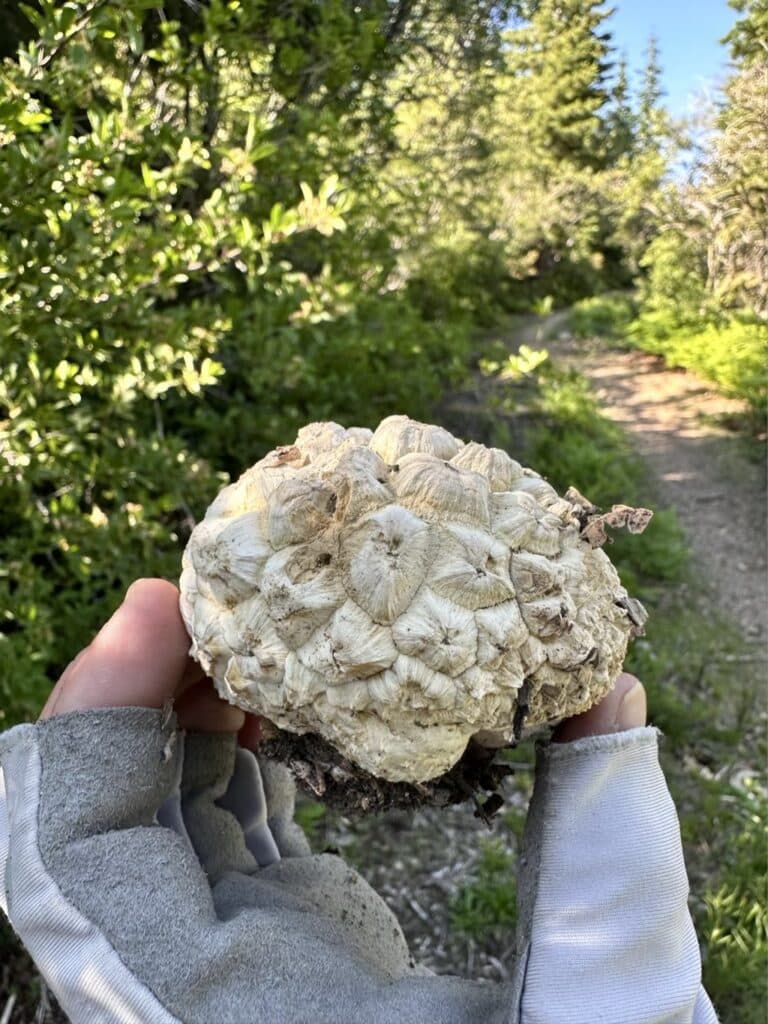
And finally some more mushrooms from this section
Get the data serious foragers use to find more mushrooms
Free members get soil temps, precipitation, and ecoregion data. Pro unlocks the layers that help you narrow down exactly where to look.
- Historical burn perimeters — find morel habitat fast
- Timber harvest boundaries across OR & WA
- Detailed foraging area summaries with conditions
- Offline maps in the Forayz iOS app